


Technologies

i93 RTK Receiver
The i93 integrates traditional GPS with photogrammetry technology. Improving comprehension of data, and overall efficiency of field work, and post-processing. Utilizing the photogrammetry technology in our surveys allows us to store georeferenced photos as it preforms topographical surveys. Granting us the ability to pull reliable data off those images in post processing, minimizing the need for re-work, and improving efficiency.

GNSS RTK iBASE
The iBase from CHCNAV keeps efficiency in mind. Using 1408 channels it produces the highest in-class quality of accuracy, and minimizes the amount of cables and batteries needed to set up. With its high powered radio it is capable of ranges up to 25kms reliably in ideal conditions.

RS10 SLAM 3D Scanner
The RS10 is a cutting-edge geospatial surveying solution that combines GNSS RTK, laser scanning, and visual SLAM, streamlining 3D scanning for both indoor and outdoor environments. It delivers high accuracy, with 3 cm RTK positioning and 5 cm measurement precision, even in challenging conditions or areas with weak GNSS signals.
With real-time SLAM capabilities, the RS10 generates georeferenced point clouds directly in the field, reducing the need for post-processing and allowing rapid adjustments. Its seamless integration of GNSS and SLAM eliminates complex workflows, making data collection faster and more efficient.
HCE600
CHCNAV Software allows us to collect and upload data seamlessly with their cloud based file sharing system. With this system, we can upload, and download important data without the need to slow down work flow, keeping our field staff highly efficient.

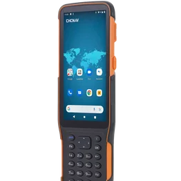
LT800

Android Smart Phone
The software is also an Android based operating system, meaning, if a data collector fails in the field, the crew can simply switch to using their Android phone, or tablet. This virtually eliminates any downtime due to equipment related issues.
